

OpenTopoMap Viewer
The Spirit of Exploration
• Embrace the call of the wild with the OpenTopoMap Viewer, the ultimate digital companion for those who find their home on the trail.
• This sophisticated web-based application is crafted specifically for the modern adventurer, whether you are a dedicated hiker, a passionate cyclist, or a backcountry explorer.
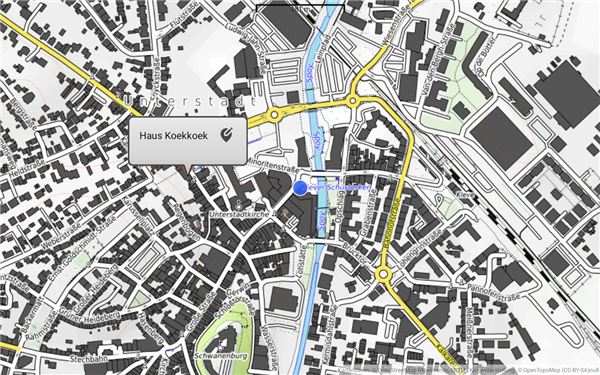
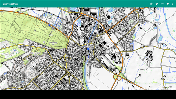
• By transforming complex topographic data into vivid, high-contrast maps, it empowers you to visualize the landscape with breathtaking clarity, turning every planned route into an invitation for discovery.
Masterful Mapping and Seamless Access
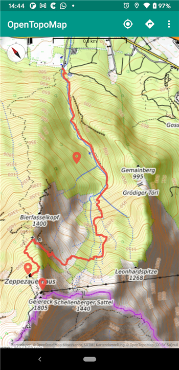
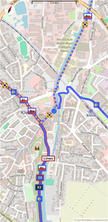
• Every great journey begins with a superior map, and this viewer delivers unparalleled precision by blending OpenStreetMap data with detailed SRTM elevation models.
• You can venture into the deepest wilderness with absolute confidence thanks to integrated local caching technology.
• This feature allows you to store essential map tiles directly on your device, ensuring that your path remains visible even when you wander far beyond the reach of cellular towers, keeping your focus on the horizon rather than the signal bar.
Precision Navigation for the Bold
• Experience the freedom of movement with real-time location tracking that follows your every step across the rugged terrain.
• To ensure your journey remains uninterrupted, the interface automatically centers on your current GPS coordinates, providing a hands-free navigation experience.
• This allows you to stay present in the moment and fully immerse yourself in the natural beauty surrounding you, while your digital guide ensures you never lose your way.
Visualizing Your Personal Odyssey
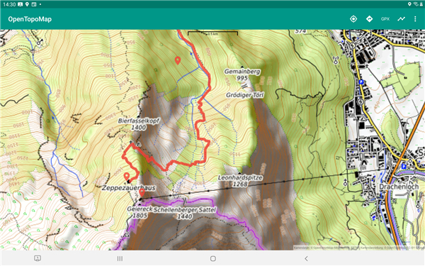
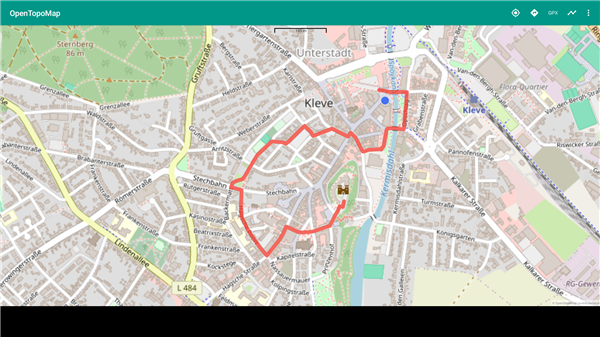
• Your unique adventures deserve a customized perspective, which is why the viewer allows you to import personal GPX files with ease.
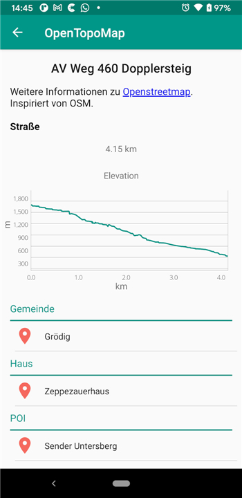
• By overlaying your planned trails and waypoints onto detailed elevation contours, you can analyze the challenges of the terrain before you even depart.
• This powerful integration turns raw data into a visual narrative of your upcoming triumph, allowing you to plot every ascent and descent with the insight of an expert guide.
Interactive Discovery and Personalized Landmarks
• The world is full of hidden treasures, and this tool helps you claim them by allowing you to place custom markers at secret campsites or essential coordinates.
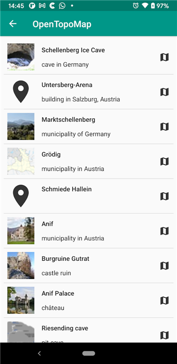
• Beyond your own notes, the viewer invites you to engage with the landscape by identifying nearby geographic features and points of interest.
• By highlighting the landmarks and natural wonders relative to your position, it encourages a deeper connection with the environment and transforms every excursion into a rich, educational experience.
FAQ
Q: Where does the app get its mapping and elevation data?
A: The viewer achieves its high level of detail by combining two powerful open data sources. It merges spatial information from OpenStreetMap with fine-grained elevation models provided by the Shuttle Radar Topography Mission, commonly known as SRTM. By blending these two sources together, the app presents rich topographic maps complete with clear contour lines and readable terrain features that make outdoor navigation intuitive.
Q: Will the map still work if I wander into an area without cellular reception?
A: Yes, you can rely on the app even deep in the wilderness! Thanks to integrated local caching technology, map tiles can be stored directly on your device. As long as you view and load your desired region while you still have an active internet connection, those cached map tiles remain accessible offline, keeping your path visible long after your signal bars disappear.
Q: How does real-time tracking work on the OpenTopoMap Viewer?
A: The application taps into your device's native GPS capabilities to monitor your exact position as you move across the terrain. To keep your trip hassle-free, the interface automatically centers on your real-time coordinates. This continuous, hands-free tracking allows you to stay present in your surroundings without needing to constantly swipe or re-adjust the map display manually.
Version History
v1.33——27 Jul 2026
An online OpenTopoMap client with caching Download the latest version of OpenTopoMap Viewer to enjoy new features and updates immediately!
*1.33
Minor bug fixes and improvements. Install or update to the newest version to check it out!
*1.32.1
Minor bug fixes and improvements. Install or update to the newest version to check it out!
*1.32
Minor bug fixes and improvements. Install or update to the newest version to check it out!
- AppSize18.70M
- System Requirements5.0 and up
- Is there a feeFree(In game purchase items)
- AppLanguage English
- Package Nameorg.nitri.opentopo
- MD5
- PublisherHelfrich
- Content RatingTeenDiverse Content Discretion Advised
- Privilege19
-
OpenTopoMap Viewer 1.33Install
18.70M2026-09-13Updated










9.3
7246 Human Evaluation
- 5 Star
- 4 Star
- 3 Star
- 2 Star
- 1 Star