
-------✦ INTRODUCTION ✦------
UTM Geo Map is a powerful mobile mapping and GIS tool designed for professionals and enthusiasts who need accurate spatial data on the go.
This all-in-one app supports land surveying, topography, bathymetry, and general geospatial analysis.
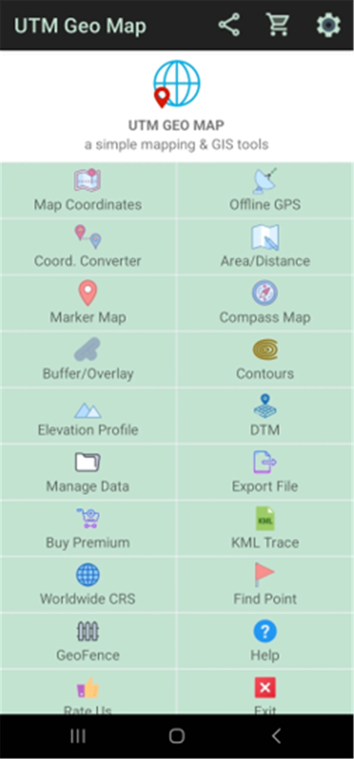
--------✦ KEY FEATURES ✦------
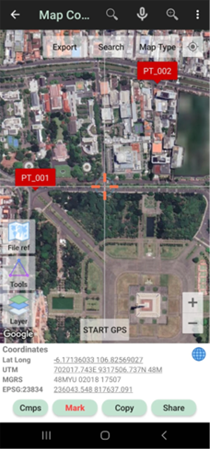
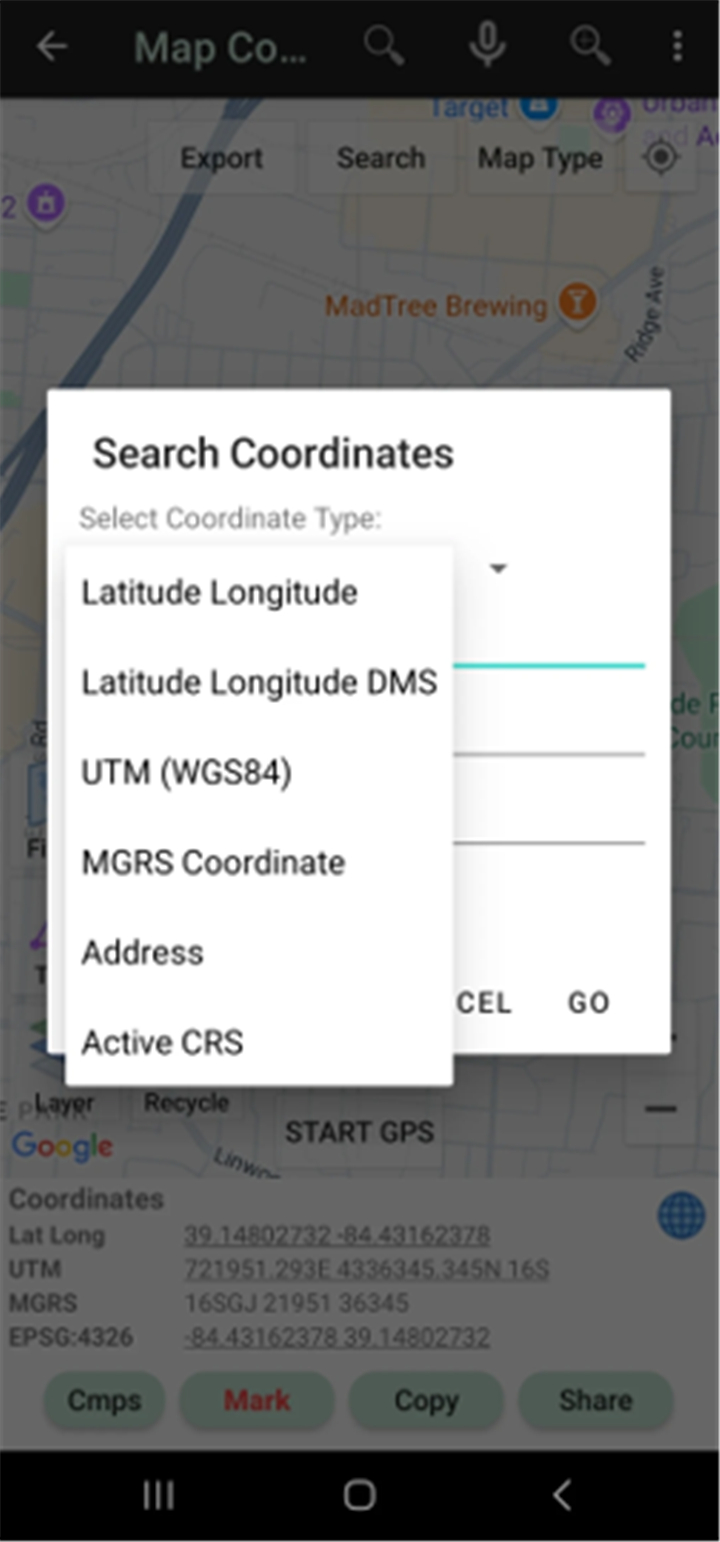
Real-Time Map Coordinates:
This feature allows users to collect and view precise latitude, longitude, UTM, MGRS, and more using EPSG codes. It also records data such as timestamps, labels, elevation, address, and images for each point.
Offline GPS Functionality:
Works without internet access, allowing you to collect coordinates, elevation, satellite data, and GPS accuracy. This key feature turns your mobile device into a handheld GPS.
Coordinate Converter:
Convert between various coordinate systems including UTM, MGRS, and latitude/longitude. Batch conversions and geocoding support make this tool efficient for complex spatial tasks.
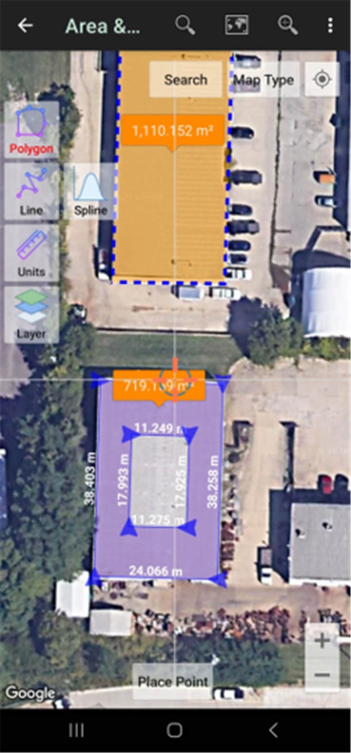
Distance & Area Measurement:
Measure land size and linear distances using units like meters, feet, acres, or hectares. This feature also enables buffer creation, overlays, and auto-polygon generation for deeper spatial analysis.
Marker Mapping Tool:
Allows advanced geometry analysis like buffers, TIN, and Voronoi diagrams from points, lines, and polygons. Useful for geospatial planning and exporting data in KML/DXF format.
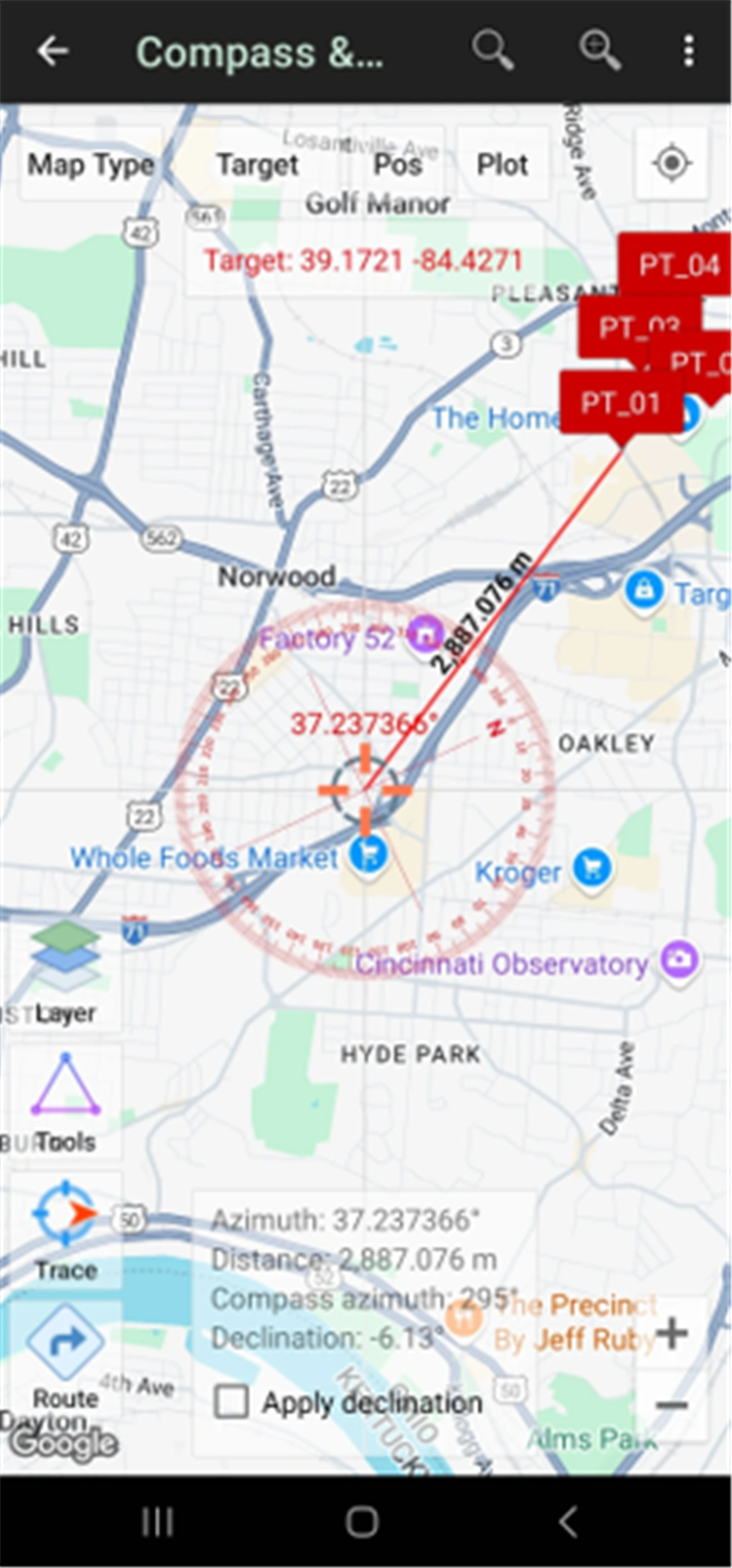
Compass & Azimuth Tool:
Built-in compass helps measure directions with magnetic declination. Ideal for field navigation and azimuth measurements.
Buffer and Overlay Tools:
Supports GIS operations like union, intersection, difference, and symmetrical difference. This feature allows users to analyze relationships between spatial features.
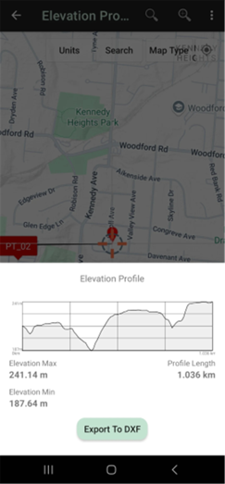
Elevation Profile Generator:
Create elevation profiles from route points or imported data. Helpful for cross-section analysis and terrain review.
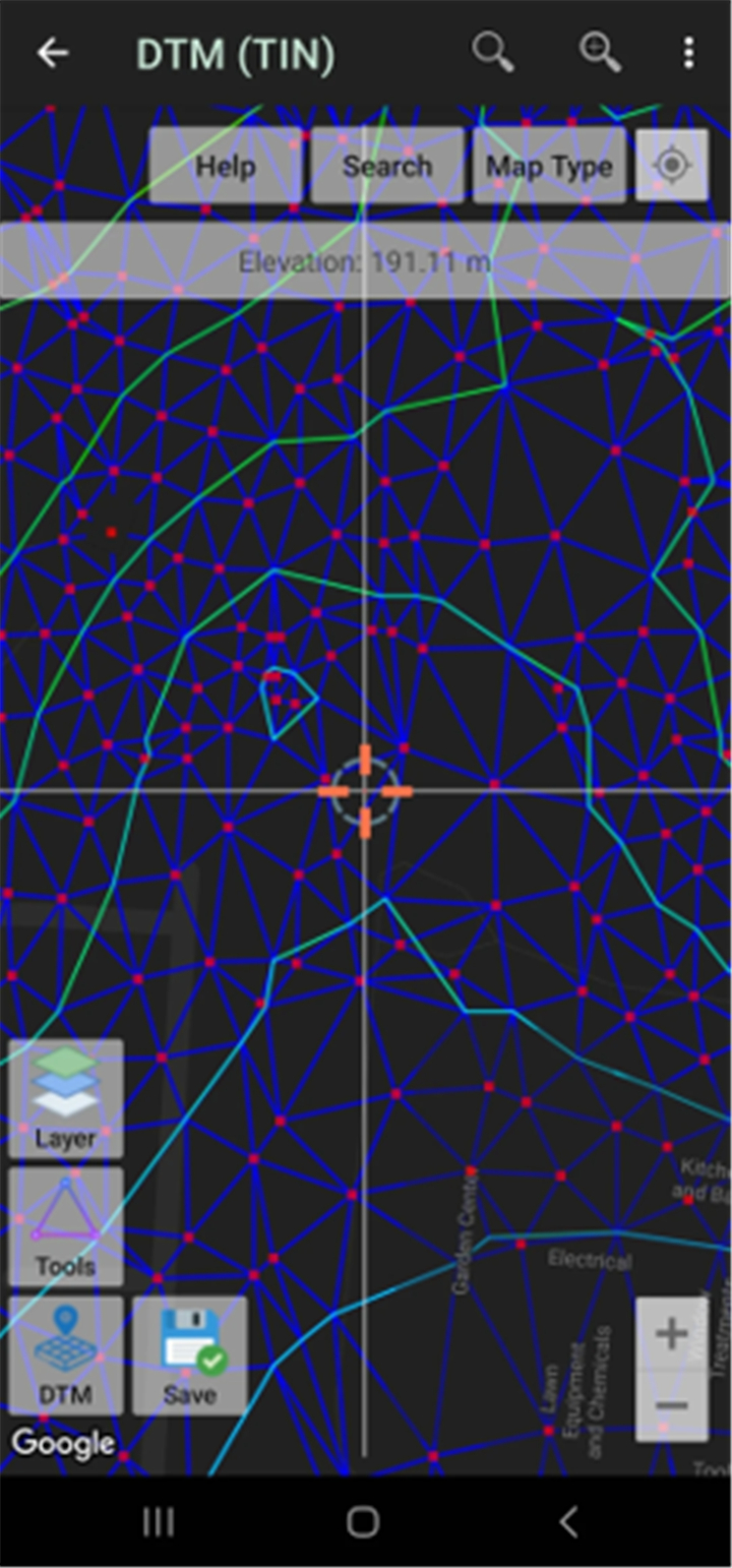
Digital Terrain Model (DTM):
Generate TIN/GRID surfaces, contour lines, and calculate cut-and-fill volumes. Useful for terrain modeling and topographic interpretation.
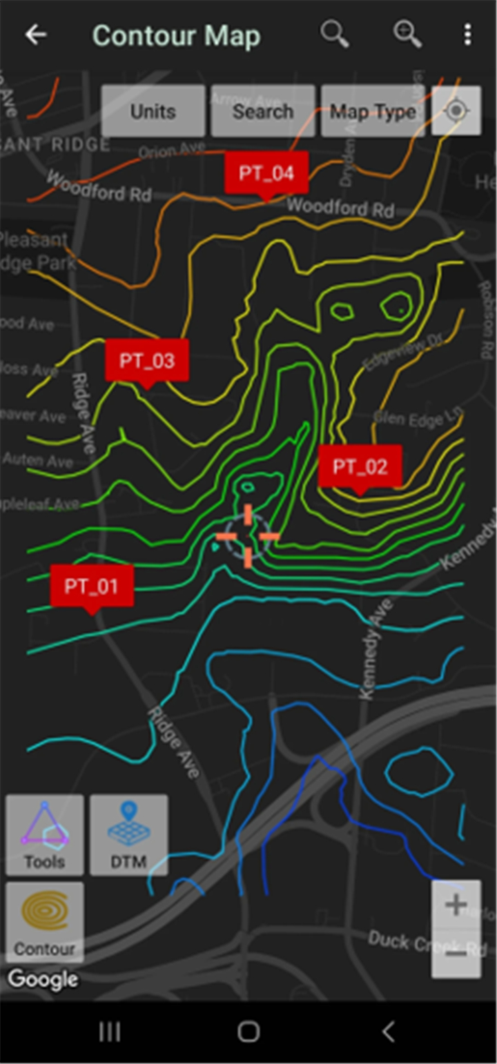
Contours Module:
Create contour lines based on elevation values, intervals, or desired density. Ideal for mapping elevation differences and planning.
Photo & Note Integration:
Capture and attach photos and notes directly to your points or polygons. This feature allows detailed documentation of field data.
--------✦ COUNTRY OF ORIGIN AND LANGUAGE ✦------
Country: Indonesia
Original Language: Indonesian
--------✦ RECOMMENDED AUDIENCES ✦------
UTM Geo Map is designed for professionals and students working in geospatial science, surveying, engineering, geology, and environmental studies.
Frequently Asked Questions (FAQ) :
Q: What coordinate systems are supported?
A: UTM Geo Map supports Latitude/Longitude, UTM, MGRS, and custom CRS using EPSG codes.
Q: Can I export my data for other GIS tools?
A: Yes, you can export data in CSV, KML, GPX, and DXF formats for use in other platforms.
Q: Does it support elevation data?
A: Yes, elevation data can be collected, used for profiles, and processed for DTM and contour generation.
Q: Can I perform buffer and overlay analysis?
A: Yes, the app includes GIS tools for buffering, union, intersection, and other overlay operations.
------------------------------------------
Contact us at the following sites if you encounter any issues:
Official website: here
Email: utmgeomapapp@gmail.com
------------------------------------------
Version History
V4.2.95----------- 14 May 2025
Bug fixes and improvements.
- AppSize12.44M
- System Requirements5.0 and up
- Is there a feeFree(In game purchase items)
- AppLanguage English
- Package Nameinfo.yogantara.utmgeomap
- MD557a4b5a225115c0419d4659a89b33d8a
- PublisherY2 Tech
- Content RatingTeenDiverse Content Discretion Advised
- Privilege19
-
UTM Geo Map 4.0.8Install
12.44M2026-03-25Updated


8.7
7690 Human Evaluation
- 5 Star
- 4 Star
- 3 Star
- 2 Star
- 1 Star