-------✦ INTRODUCTION ✦------
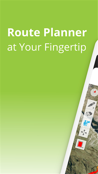
TouchTrails is a user-friendly route planner designed for outdoor enthusiasts, allowing you to easily create and customize routes for all your adventures.
Whether you're planning a bike ride, a multi-day hike, or any outdoor activity, this app provides the tools you need to navigate with confidence.
--------✦ KEY FEATURES ✦------
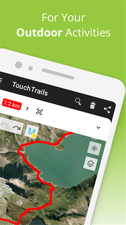
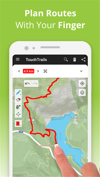
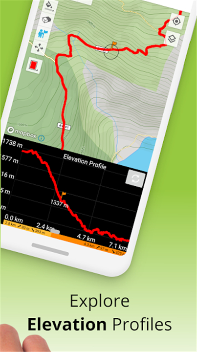
Measure Distance and Elevation
Get accurate distance measurements and detailed elevation profiles to understand the challenges of your journey. This feature helps you prepare for the terrain ahead, ensuring you know how far and how high your adventure will take you.
Add and Edit Waypoints
Enhance your maps with waypoints that highlight points of interest, tips, and other important information. With an extensive library of waypoint icons, you can customize your map to suit your needs and make your journey more enjoyable.
GPS Tracker
Record your adventures with the built-in GPS tracker. Save, edit, or share your journeys with friends, allowing them to join in on your outdoor experiences.
GPX Viewer
If you find a perfect trail online, you can easily import GPX files into TouchTrails. Navigate along these routes, measure distances, and analyze elevation profiles, giving you the flexibility to explore new paths.
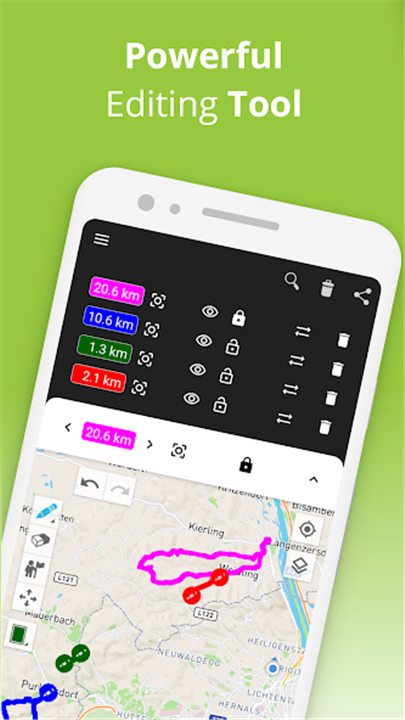
Multiple Routes on One Map
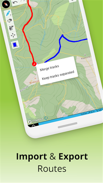
TouchTrails allows you to view multiple routes simultaneously on one map. This feature enables you to combine and connect routes from different sources, providing a comprehensive overview of your planned adventures.
------✦ COUNTRY OF ORIGIN AND LANGUAGE ✦------
Country: Austria
Original Language: English
--------✦ RECOMMENDED AUDIENCES ✦----
TouchTrails is perfect for outdoor enthusiasts of all kinds, including hikers, cyclists, runners, and motorcyclists.
Whether you're a casual walker or a seasoned adventurer, this app caters to your needs by providing essential tools for planning and navigating your routes.
Frequently Asked Questions (FAQ) :
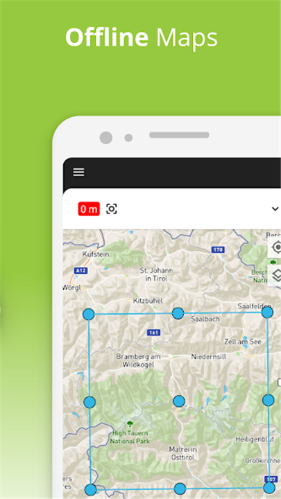
Q: Can I use the app offline?
A: Yes, TouchTrails allows you to download maps for offline use, ensuring you can navigate even when you don't have an internet connection.
Q: How do I import GPX files into the app?
A: You can easily import GPX files from various sources directly into TouchTrails, allowing you to navigate pre-planned routes effortlessly.
Q: What is the "snap to road" feature?
A: The "snap to road" feature locks your route onto any road, bike path, or hiking trail, helping you stay on track during your adventures.
------------------------------------------
Contact us at the following sites if you encounter any issues:
Official Website: Here
Email: contact@wolfgang-knecht.com
Phone Number: +43 677 61991210
-----------------------------------------
Version History
v2.13.9 ---- 9 May 2025
• Improved elevation profile
• Fixed bugs
- AppSize34.81M
- System Requirements5.0 and up
- Is there a feeFree(In game purchase items)
- AppLanguage English
- Package Namecom.wolfgangknecht.sketchatrack
- MD56169f4e72982d7542cb0e3dafe8e2684
- Publisherpixelclash
- Content RatingTeenDiverse Content Discretion Advised
- Privilege19
-
TouchTrails: Route Planner 2.12.0Install
34.81M2026-03-25Updated


7.5
9758 Human Evaluation
- 5 Star
- 4 Star
- 3 Star
- 2 Star
- 1 Star