
-------✦ INTRODUCTION ✦------
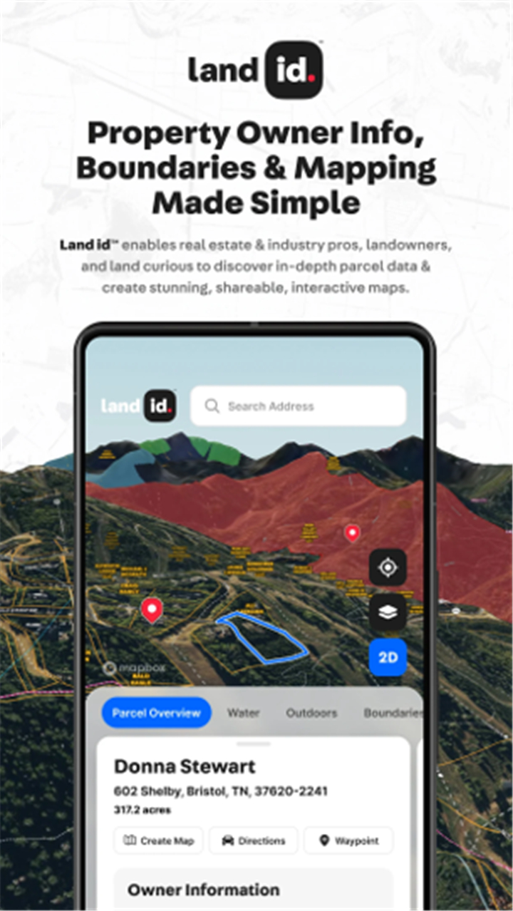
Land id™ is a powerful mobile app designed to transform how users view, research, and manage land and property.
Explore over 155 million parcels across the U.S. with detailed ownership information, terrain analysis, soil data, and more.
The app brings every location to life with high-resolution 2D and 3D mapping, offering tools for property research, due diligence, and professional land management.
--------✦ KEY FEATURES ✦------
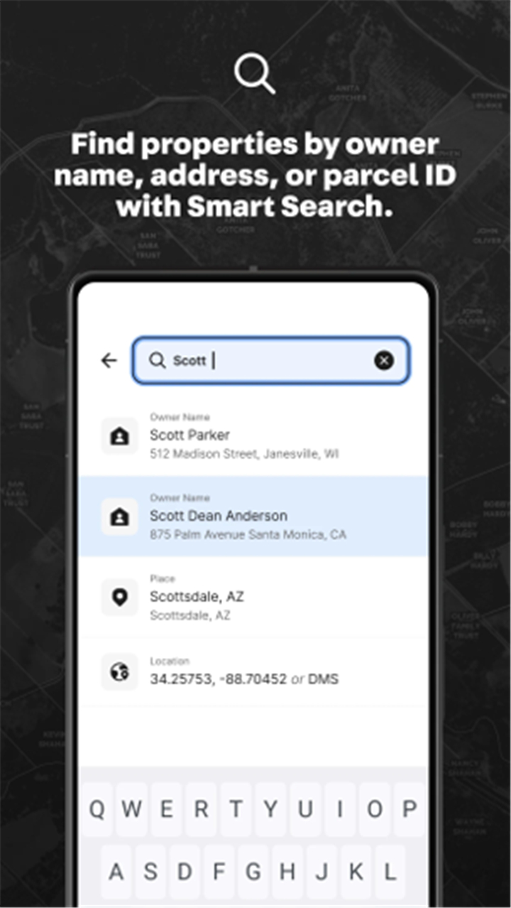
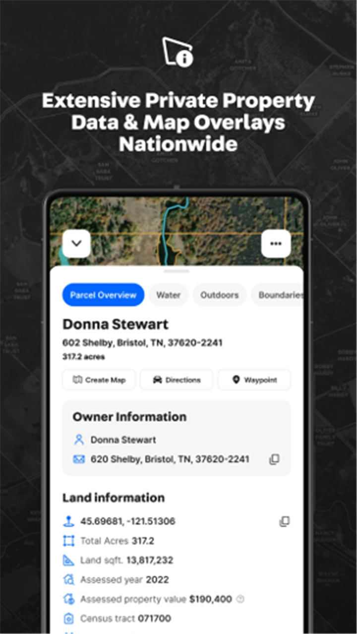
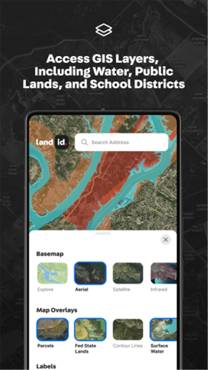
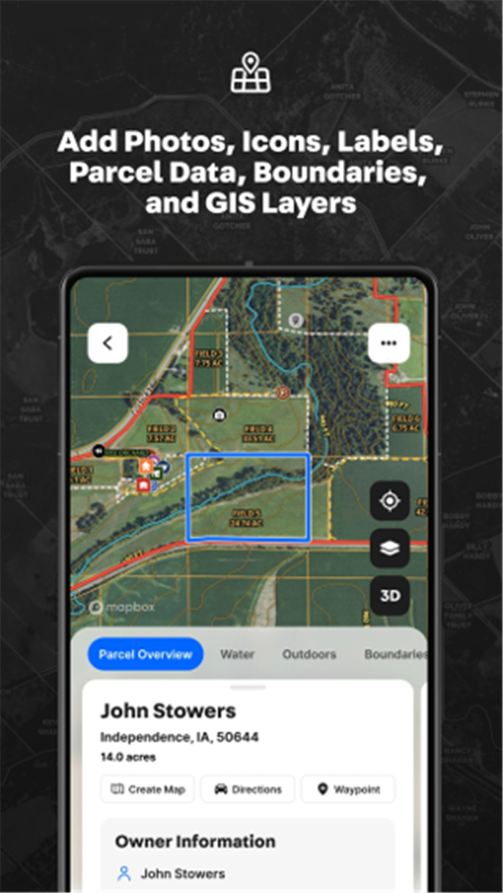
Property boundaries and ownership data:
This feature allows users to access accurate land boundaries and in-depth property ownership information, including acreage, land usage, and tax details.
One-tap property data cards:
This key feature allows instant viewing of critical parcel data such as landowner name, previous sale price, tax history, and zoning usage.
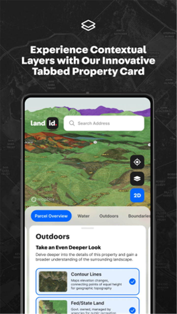
2D and 3D property visualization:
This feature allows users to switch between 2D and immersive 3D views, making it easier to understand terrain, structures, and surrounding areas.
Contour lines and topography:
This feature allows better land evaluation by displaying elevation changes and true terrain features, useful for planning and development.
Fiber optic and service availability maps:
This key feature allows users to visualize fiber optic density and available infrastructure services across regions.
Floodplain and groundwater information:
This feature gives access to FEMA floodplain data and groundwater insights, supporting risk assessment and environmental research.
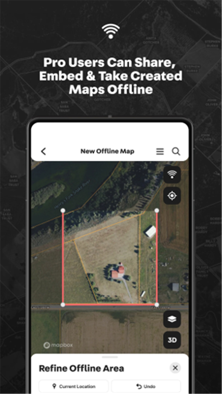
Offline map access and GPS tracking:
This feature allows users to download maps and track their location in the field without an internet connection.
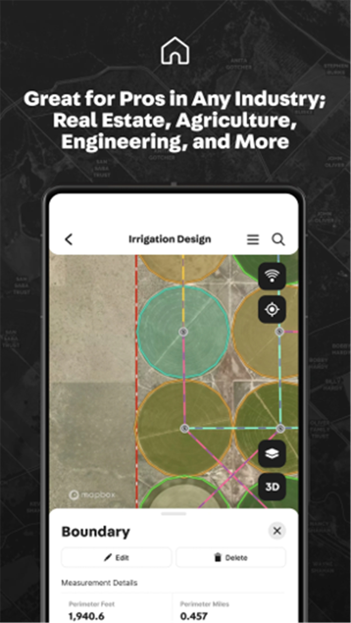
Waypoint and markup tools:
This feature allows marking specific locations, drawing lines, adding notes, and uploading photos directly to the map.
Soil and land use information:
This key feature allows users to identify soil types and land classifications, important for agricultural or developmental decisions.
Map creation and sharing (Premium):
This feature allows users to create up to 3 custom maps, add icons and annotations, and share via links.
High-resolution aerial imagery (Premium):
This feature allows clearer, more detailed visual context for professional use and presentations.
Website embedding and branding (Pro):
This feature allows professionals to embed maps into listings, customize with their brand, and use rich media like video points.
CSV report generation (Pro):
This allows users to export mailing lists and data summaries for large-scale land research and outreach.
--------✦ COUNTRY OF ORIGIN AND LANGUAGE ✦------
Country: United States
Original Language: English
--------✦ RECOMMENDED AUDIENCES ✦------
Land id™ is highly recommended for real estate professionals, investors, surveyors, appraisers, land managers, and anyone conducting property research or due diligence.
It's also useful for government agencies, environmental analysts, and developers who require reliable data and mapping tools for land planning and documentation.
Frequently Asked Questions (FAQ) :
Q: Can I try Land id™ for free?
A: Yes, the app offers a free 7-day trial with full access to all features and plans.
Q: What type of property data does Land id™ provide?
A: The app provides ownership information, parcel boundaries, land usage, tax data, previous sale details, and more.
------------------------------------------
Contact us at the following sites if you encounter any issues:
Official website: here
Email: support@id.land
------------------------------------------
Version History
V5.14.0--------- 24 Jun 2025
Bug fixes and improvements.
- AppSize37.54M
- System Requirements5.0 and up
- Is there a feeFree(In game purchase items)
- AppLanguage English
- Package Namecom.mapright.android
- MD581925033A50B55F8063007EAE5A97872
- PublisherLand id™
- Content RatingTeenDiverse Content Discretion Advised
- Privilege19
-
Land id™ 5.3.1Install
37.54M2026-03-24Updated


7.9
5299 Human Evaluation
- 5 Star
- 4 Star
- 3 Star
- 2 Star
- 1 Star