-------✦ INTRODUCTION ✦------
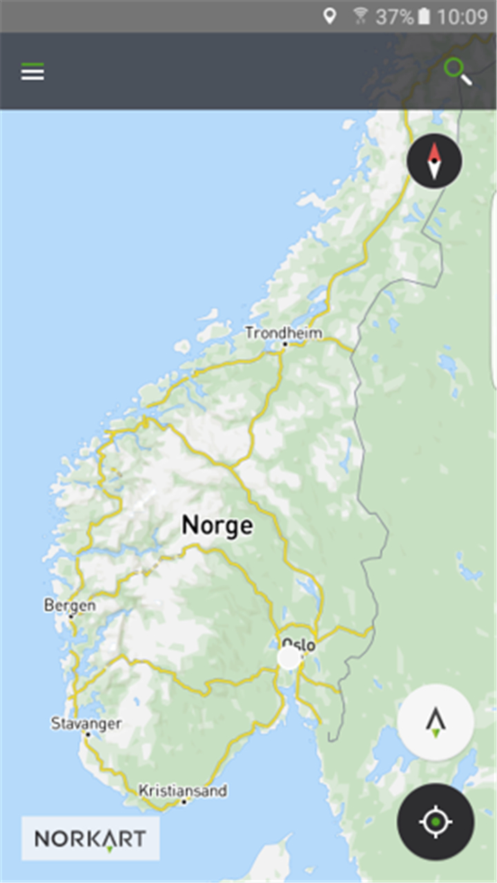
Kommunekart is the official mapping app that gives users access to detailed maps, aerial images, property data, and municipal plans across Norway.
With this app, you can explore your surroundings, search for addresses or places, view zoning plans, and even get turn-by-turn directions.
--------✦ KEY FEATURES ✦------
Free Access to Detailed Maps:
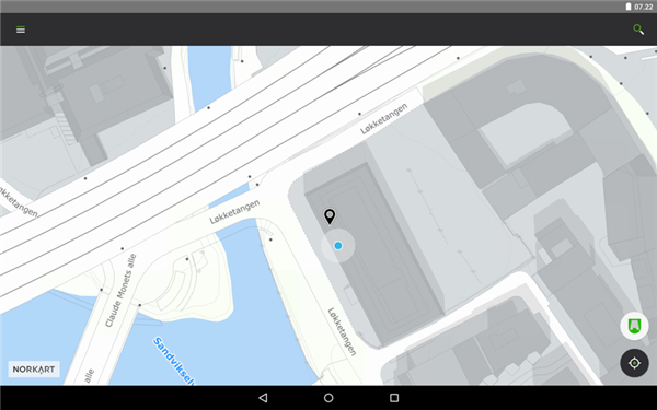
This feature allows full access to detailed topographic and property maps of all municipalities in Norway without download limits.
Aerial and Satellite Images:
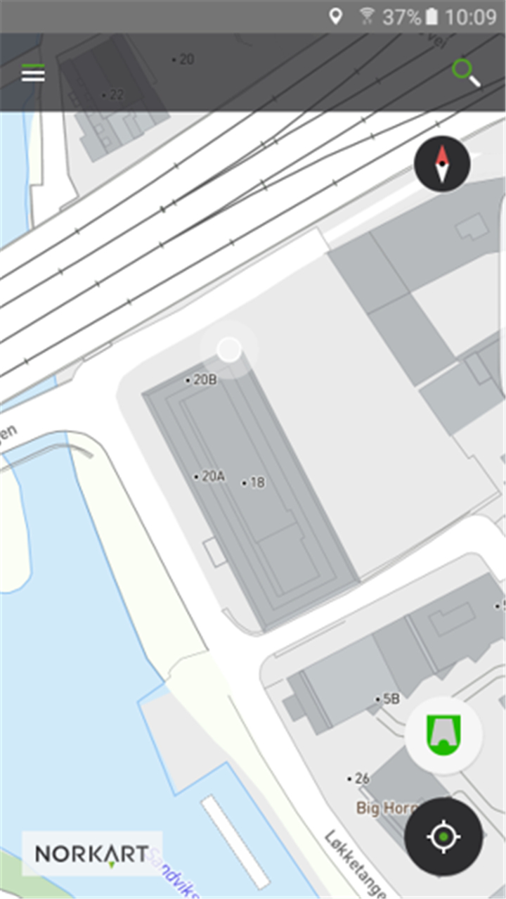
This feature allows users to view high-resolution aerial imagery to analyze terrain, developments, or land usage in real-time.
Property Search:
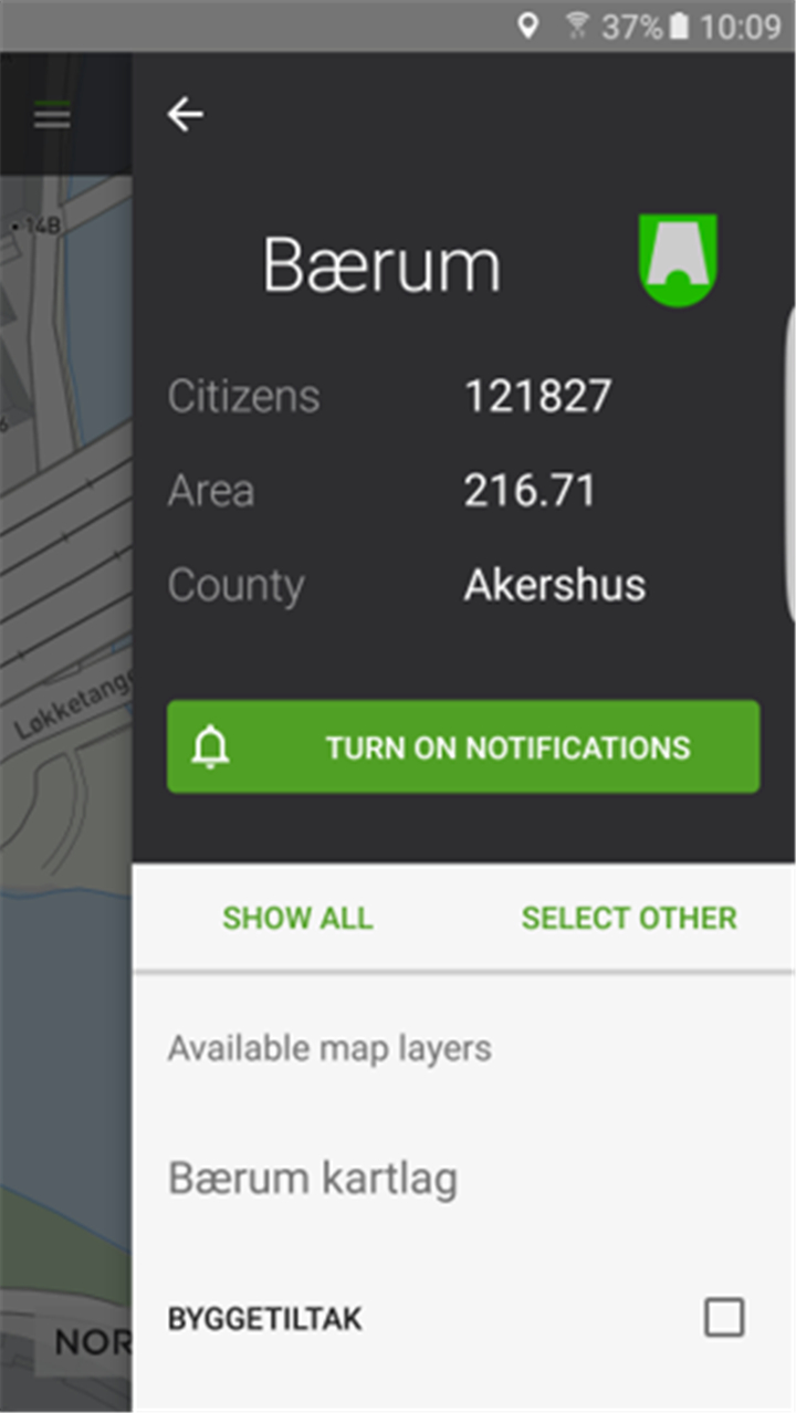
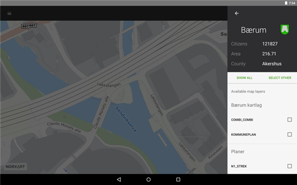
This feature allows easy lookup of property boundaries, addresses, and land registry information across the country.
Turn-by-Turn Navigation:
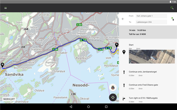
This key feature allows users to generate route directions to any location in Norway with step-by-step driving guidance.
Zoning and Construction Info:
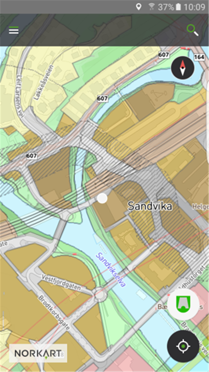
This feature allows residents of supported municipalities to access zoning plans and approved building details within their area.
Interactive Map Tools:
This feature allows users to interact with various map layers, filter information, and customize their viewing experience based on region and needs.
Support for Multiple Municipalities:
This feature allows extended access to in-depth municipal data in over 300 local authorities, including cities like Bergen, Tromsø, and Kristiansand.
Offline Access Settings:
This feature allows users to save map data and manage GPS settings to conserve battery life during prolonged use.
--------✦ COUNTRY OF ORIGIN AND LANGUAGE ✦------
Country: Norway
Original Language: Norwegian
--------✦ RECOMMENDED AUDIENCES ✦------
Kommunekart is ideal for Norwegian residents, municipal staff, real estate professionals, and outdoor enthusiasts.
It's designed for anyone who needs access to accurate and official mapping data whether for planning, exploring, or property research.
Frequently Asked Questions (FAQ) :
Q: How do I access property information?
A: Simply search by address or location and tap on the map to view detailed property boundaries and registration data.
Q: Is Kommunekart free to use?
A: Yes, all core features including maps, aerial views, and property lookups are free to use with no daily download limits.
Q: Does the app support my municipality?
A: Kommunekart supports over 300 municipalities. Check the full list in the app or above to confirm coverage.
Q: Can I get construction or zoning plan details in my area?
A: Yes, if your municipality is supported, you can view approved zoning and construction plans directly within the app.
------------------------------------------
Contact us at the following sites if you encounter any issues:
Official website: here
Email: gisline@norkart.no
------------------------------------------
Version History
V2.5.4----------- 18 Jun 2025
Bug fixes and improvements.
- AppSize74.83M
- System Requirements5.0 and up
- Is there a feeFree(In game purchase items)
- AppLanguage English
- Package Nameno.nkgs.webatlas.android.munmed
- MD572a7e675ef50a45551dd6dcaa4b3da97
- PublisherNorkart AS
- Content RatingTeenDiverse Content Discretion Advised
- Privilege19

-
Kommunekart 2.5.4Install
74.83M2026-03-24Updated


8.7
133 Human Evaluation
- 5 Star
- 4 Star
- 3 Star
- 2 Star
- 1 Star