-------✦ INTRODUCTION ✦------
Denmark Topo Maps is an easy-to-use outdoor/offline GPS navigation app designed specifically for outdoor enthusiasts exploring Denmark's beautiful landscapes.
This app transforms your Android phone or tablet into a powerful outdoor GPS, providing essential mapping options similar to those found in Garmin or Magellan handheld devices.
--------✦ KEY FEATURES ✦------
Offline Navigation Capabilities
The app's PRO features allow for offline usage, making it ideal for trips into areas without cell coverage. You can easily download map tiles for offline use, ensuring you have access to essential navigation tools without worrying about roaming fees or signal loss.
Waypoint and Route Management
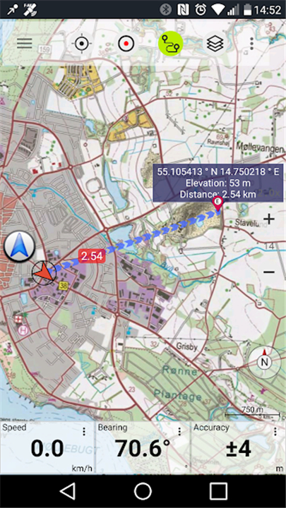
The GoTo-Waypoint Navigation feature ensures that you can efficiently reach your destination. Additionally, the app supports route creation and navigation, allowing for seamless point-to-point travel.
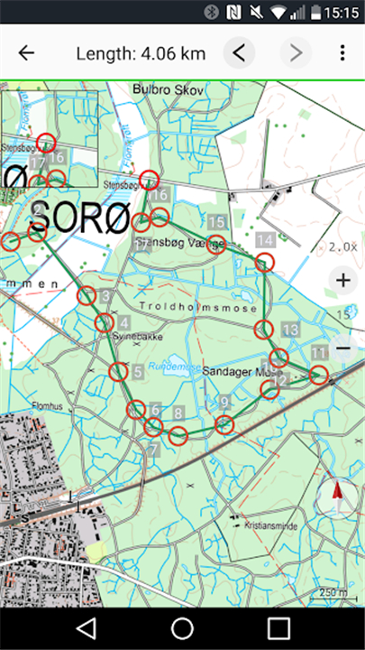
Track Recording and Statistics
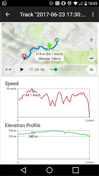
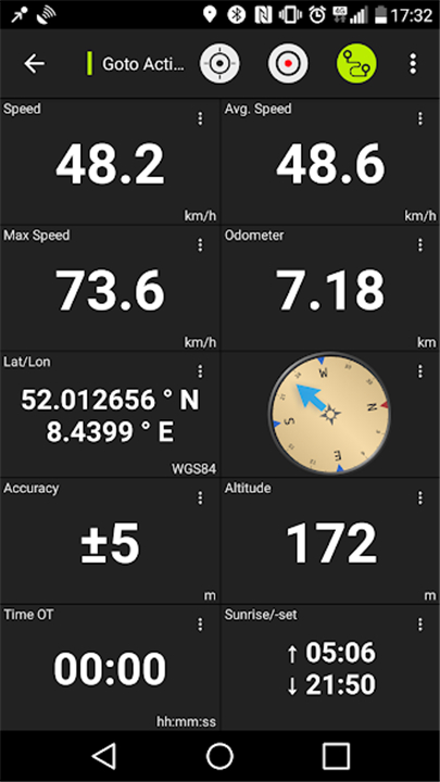
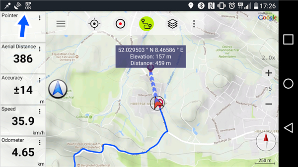
Users can record tracks with detailed statistics, including speed, elevation, and accuracy profiles. The Tripmaster feature displays important information such as odometer readings, average speed, and bearing, helping you keep track of your outdoor adventures.
Customizable Data Fields
The app offers customizable data fields in both the map view and Tripmaster, allowing you to display specific information such as speed, distance, and compass direction. This flexibility ensures that you can tailor the app to suit your individual navigation needs.
Sharing and Exporting Features
Denmark Topo Maps makes it easy to share waypoints, tracks, and routes via email, social media, or cloud services like Dropbox. Additionally, you can import and export GPS data in GPX, KML, or KMZ formats for compatibility with other GPS devices and applications.
------✦ COUNTRY OF ORIGIN AND LANGUAGE ✦------
Country: Germany
Original Language: English
--------✦ RECOMMENDED AUDIENCES ✦----
Denmark Topo Maps is ideal for outdoor enthusiasts who enjoy hiking, biking, camping, climbing, skiing, canoeing, and more.
Whether you're a seasoned adventurer or a casual explorer, this app provides the necessary tools to enhance your outdoor experiences
Frequently Asked Questions (FAQ) :
Q: What types of maps are available in the app?
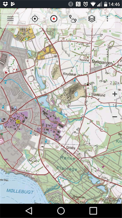
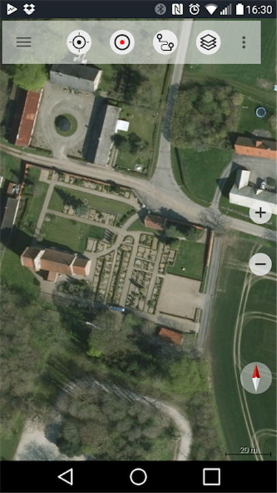
A: The app includes topographic maps, aerial imagery, historical topo maps, and several layers from ESRI and OpenStreetMap.
Q: Can I create and share waypoints?
A: Yes, you can create and edit waypoints, as well as share them via email or social media.
Q: How can I download maps for offline use?
A: To download maps for offline use, you need to purchase the PRO features that enable easy and fast bulk downloads of map tiles.
------------------------------------------
Contact us at the following sites if you encounter any issues:
Official website: Here
Email: google@atlogis.com / support@atlogis.com (Developer)
Phone Number: +49 171 1738949 (Developer)
-----------------------------------------
Version History
v7.8.0 ---- 29 Apr 2025
Shapes: Import vector features from shapes, geojson and kml/kmz
Android 15 support
Bug fixes & Improvements
- AppSize16.86M
- System Requirements5.0 and up
- Is there a feeFree(In game purchase items)
- AppLanguage English
- Package Namecom.atlogis.denmark
- MD58716670d08683dcdc2639aed1aec16a1
- PublisherATLOGIS Geoinformatics GmbH & Co. KG
- Content RatingTeenDiverse Content Discretion Advised
- Privilege19
-
Denmark Topo Maps 7.2.0Install
16.86M2026-03-25Updated


8.0
5518 Human Evaluation
- 5 Star
- 4 Star
- 3 Star
- 2 Star
- 1 Star