
-------✦ INTRODUCTION ✦------
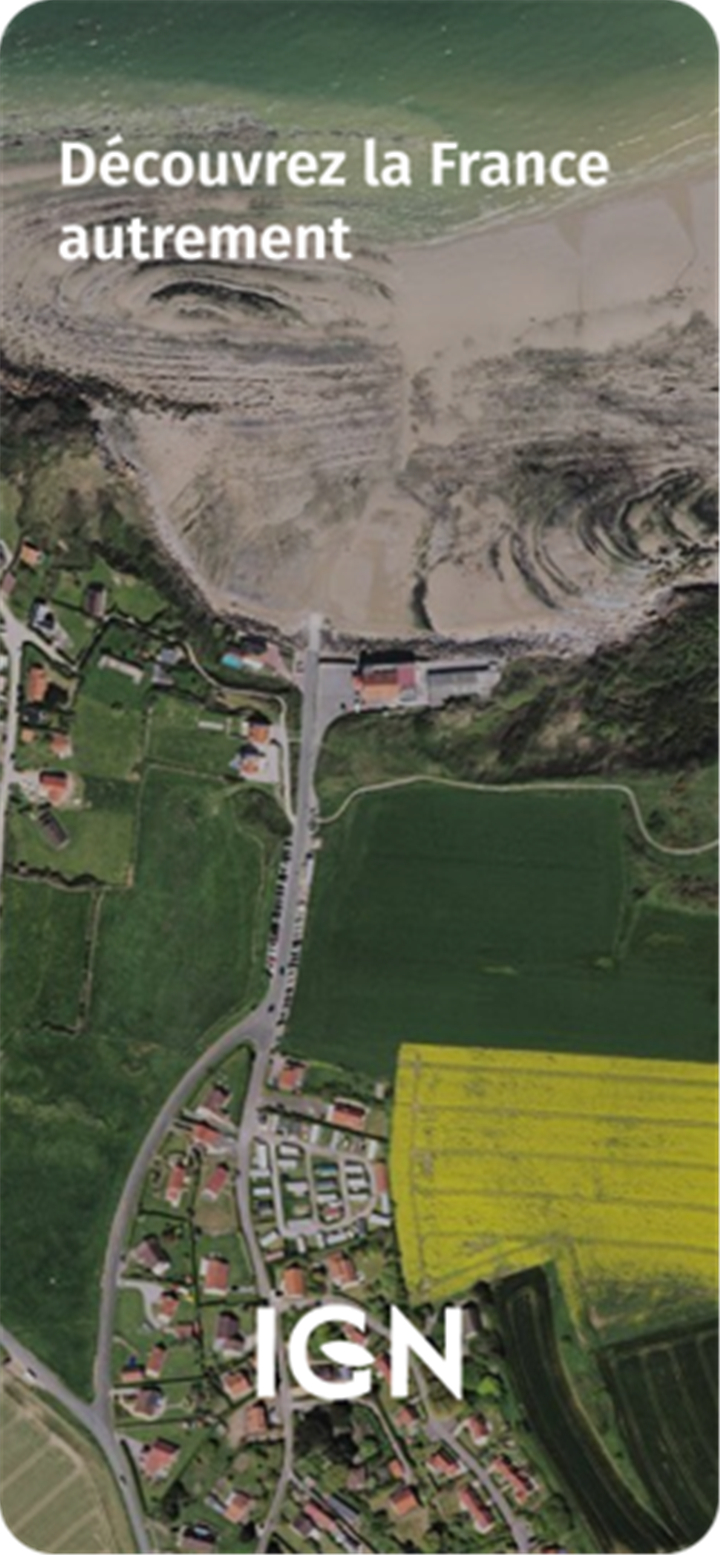
Cartes IGN is a free navigation and map exploration app that lets users discover France with unmatched detail.
Designed by the National Institute of Geographic and Forest Information (IGN), this app combines high-precision topographic maps with a variety of rich data layers.
From land use to historical landscape changes, Cartes IGN offers powerful tools for exploring and understanding French geography.
--------✦ KEY FEATURES ✦------
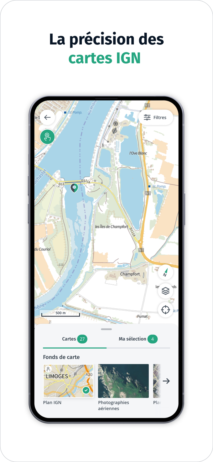
Detailed Topographic Maps:
This feature provides access to precise IGN maps, allowing users to explore natural and urban environments in high resolution.
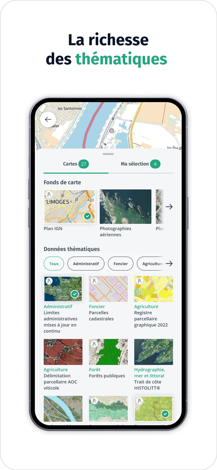
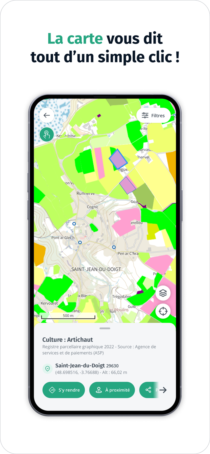
Interactive Territory Information:
Clicking on the map reveals specific data like building characteristics, land usage, or field types, making it a practical tool for students, researchers, and curious explorers.
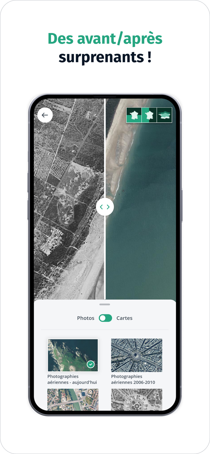
Historical Aerial Imagery:
This key feature allows comparing past and present aerial photos and maps to observe environmental changes over time.
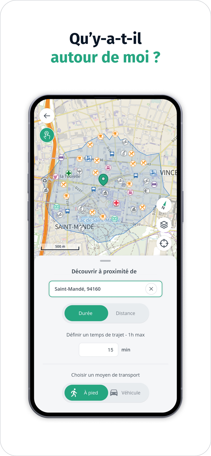
Points of Interest Nearby:
Discover cultural, natural, or tourist points around your location. This feature allows travelers to find unique spots easily.
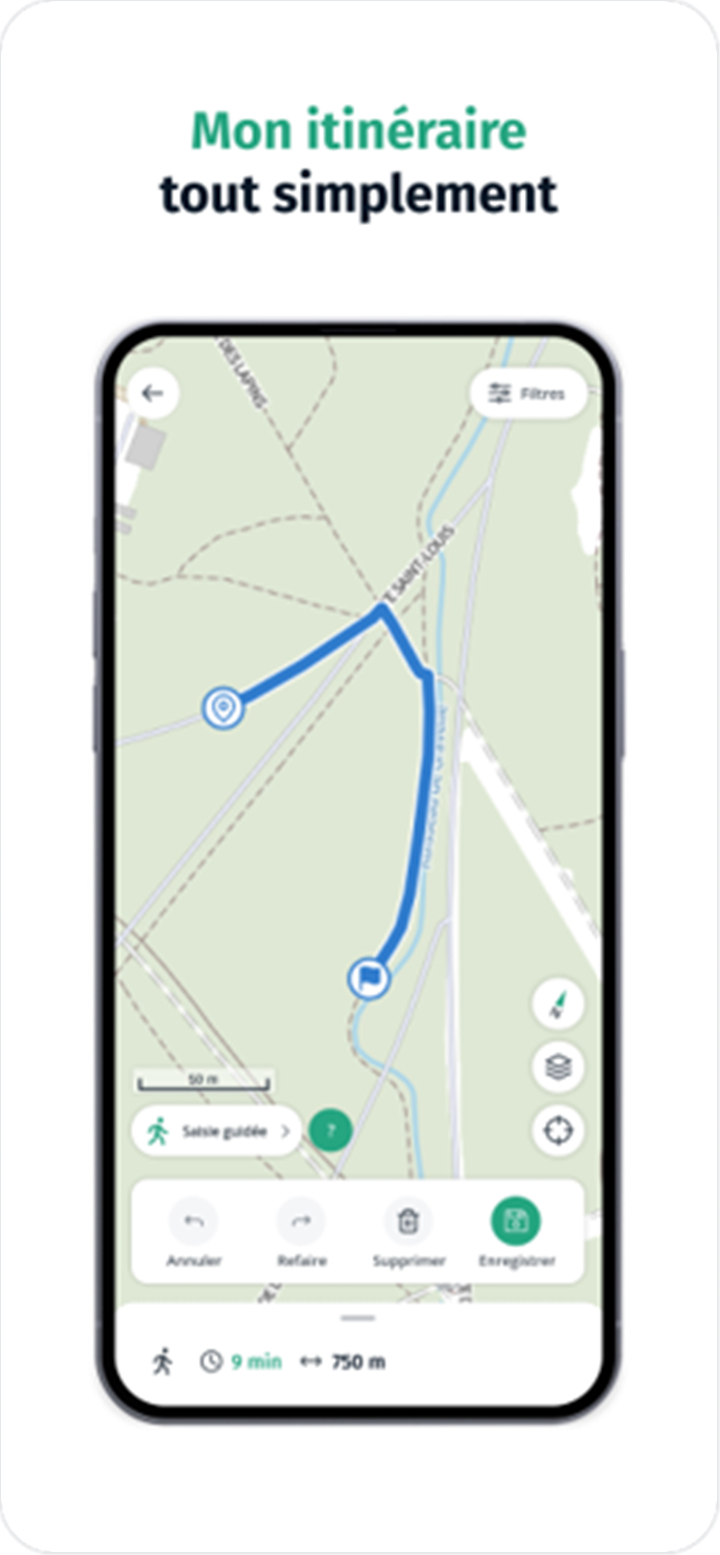
Route Planning and GPS Tools:
Users can trace custom routes, calculate directions, display their GPS position, and share it all without compromising privacy.
Offline Access Support:
This feature allows downloading map data to explore areas without needing constant internet access.
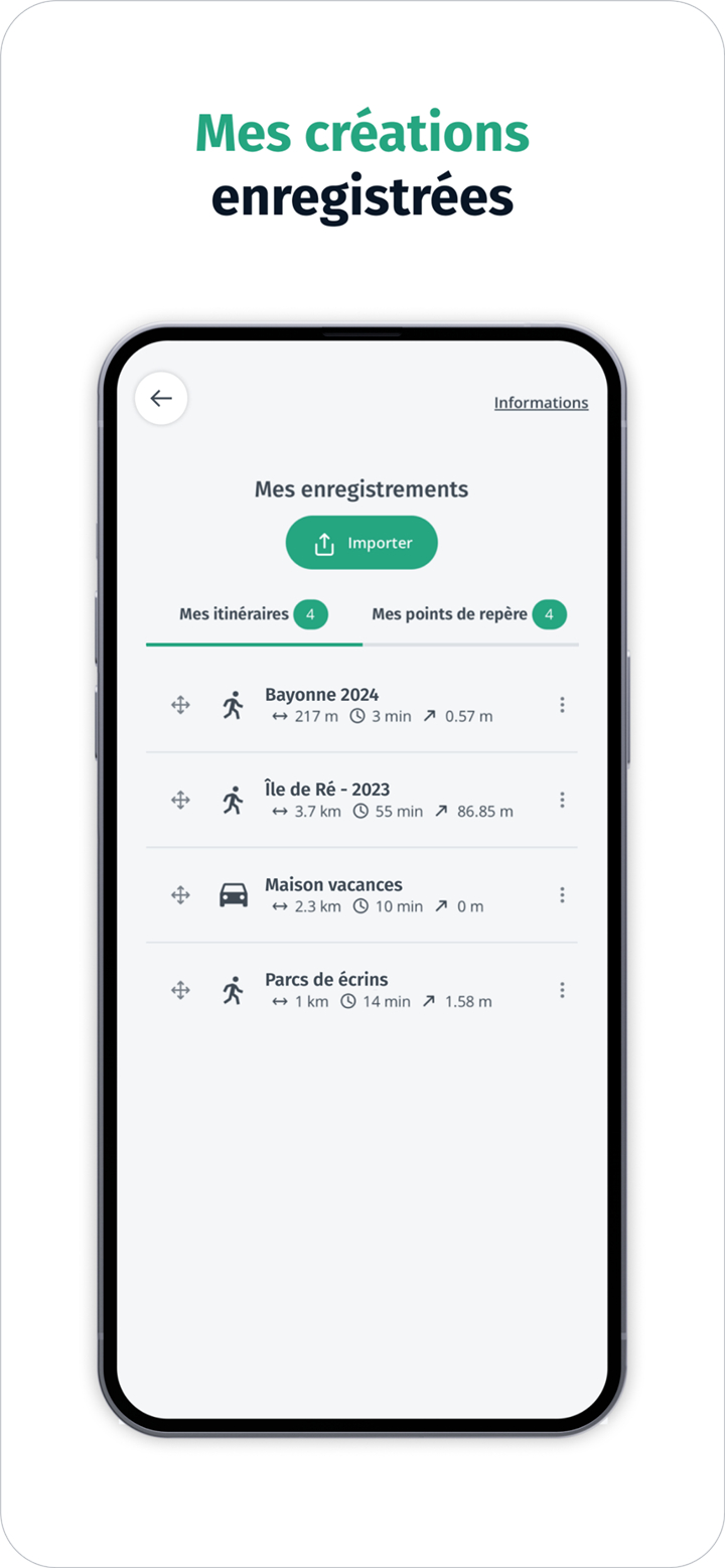
Create and Save Landmarks:
Users can mark personal locations and routes, making it easier to revisit or share those coordinates with others.
User-Friendly Interface:
The app's design offers smooth navigation and quick access to layers, maps, and features even for first-time users.
--------✦ COUNTRY OF ORIGIN AND LANGUAGE ✦------
Country: France
Original Language: French
--------✦ RECOMMENDED AUDIENCES ✦------
Cartes IGN is perfect for hikers, nature lovers, travelers, educators, and professionals in fields like geography, agriculture, and land management.
It is also a useful tool for anyone who enjoys exploring France in detail and learning about the evolution of its landscapes.
Frequently Asked Questions (FAQ) :
Q: What makes Cartes IGN different from other map apps?
A: It offers high-resolution official IGN maps and unique data layers like land use, historical changes, and building insights.
Q: Is the app suitable for educational purposes?
A: Yes, the app provides valuable data and visual tools that are perfect for learning and teaching geography or environmental studies.
Q: Does Cartes IGN support real-time navigation?
A: While it is not a turn-by-turn GPS app, it offers route tracing and positioning features for manual navigation.
Q: Can I view changes in land and territory over time?
A: Yes, the app includes tools to compare old and current maps or aerial views to observe changes in the landscape.
------------------------------------------
Contact us at the following sites if you encounter any issues:
Official website: here
Email: contact.geoservices@ign.fr
------------------------------------------
Version History
V3.3.32------------ 28 Jul 2025
Bug fixes and improvements.
- AppSize13.01M
- System Requirements5.0 and up
- Is there a feeFree(In game purchase items)
- AppLanguage English
- Package Namefr.ign.geoportail
- MD51eac1a658d18201224d929dd422cdf08
- PublisherIGN-France
- Content RatingTeenDiverse Content Discretion Advised
- Privilege19
-
Cartes IGN 3.3.32Install
13.01M2026-03-14Updated


8.2
6900 Human Evaluation
- 5 Star
- 4 Star
- 3 Star
- 2 Star
- 1 Star