
-------✦ INTRODUCTION ✦------
Avia Maps Aeronautical Charts is a powerful mobile tool for pilots and aviation enthusiasts, designed for both flight planning and in-flight navigation.
With intuitive ICAO-style maps, global airport data, terrain awareness, and weather overlays, this app gives you everything you need in one place online or offline.
Built for reliability and clarity, it turns your phone or tablet into an essential cockpit resource.
--------✦ KEY FEATURES ✦------
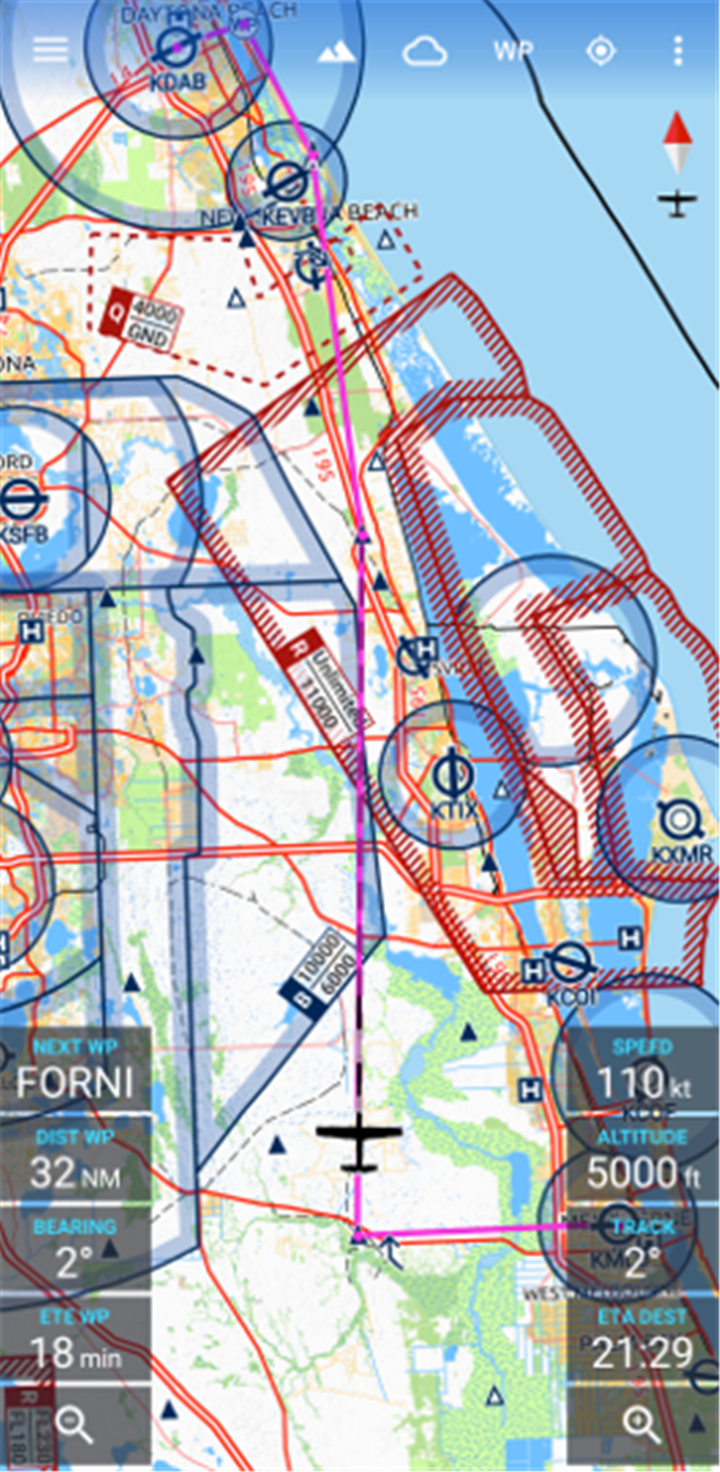
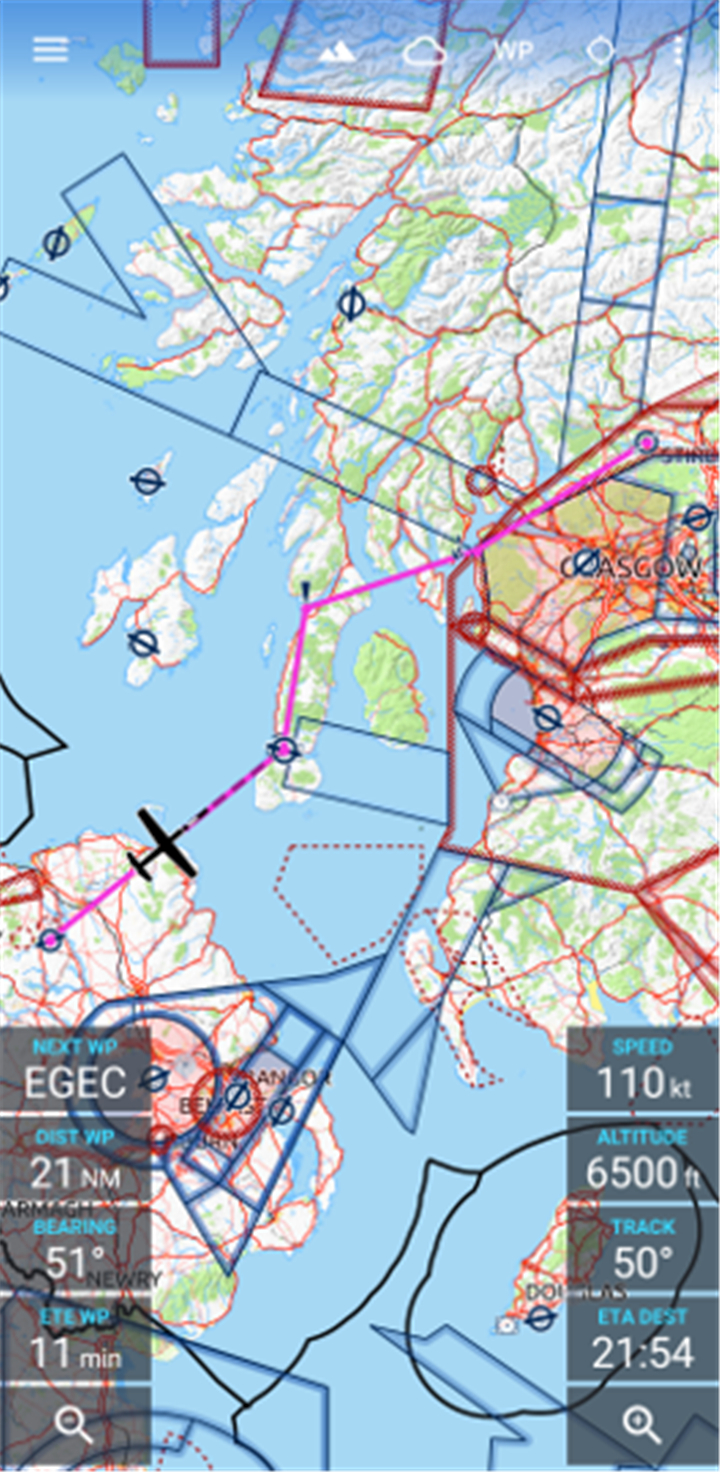
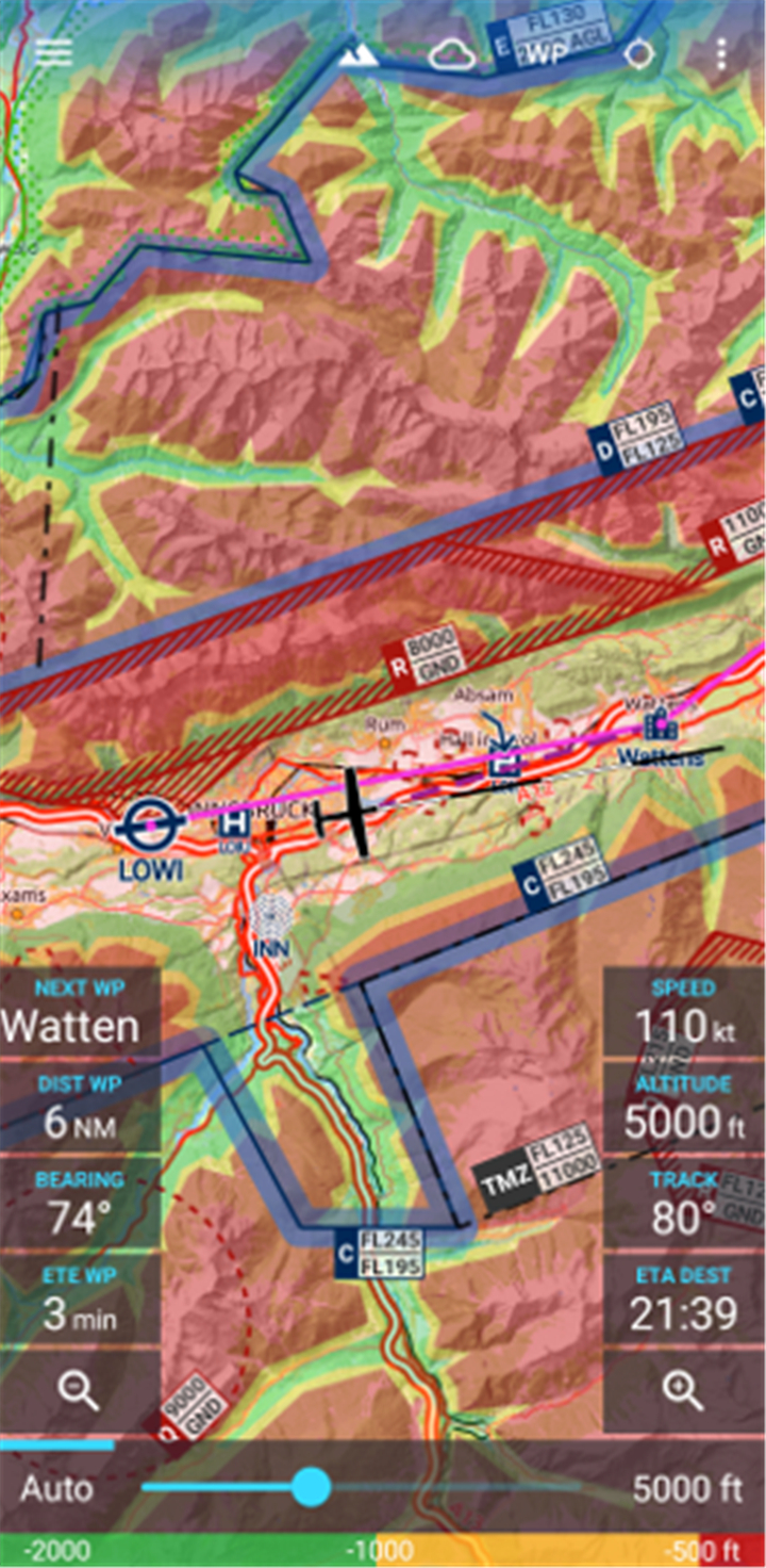
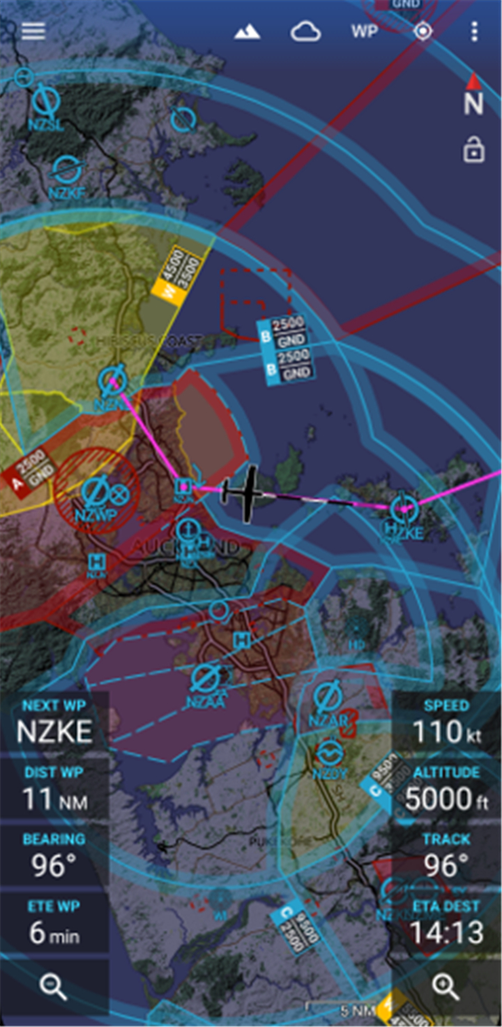
Global Aeronautical Map Coverage:
This feature allows worldwide access to over 65,000 airports, 9,000 navaids, and 15,000 waypoints with detailed airspaces for 62 countries. Perfect for cross-border planning and navigation.
Offline Map Downloads:
This feature allows pilots to download 5x5 degree map sections for offline use ideal for flights in areas with no internet connectivity.
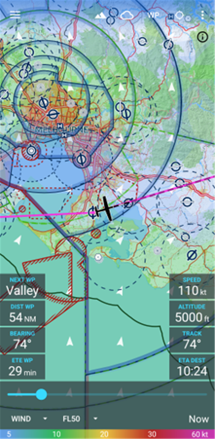
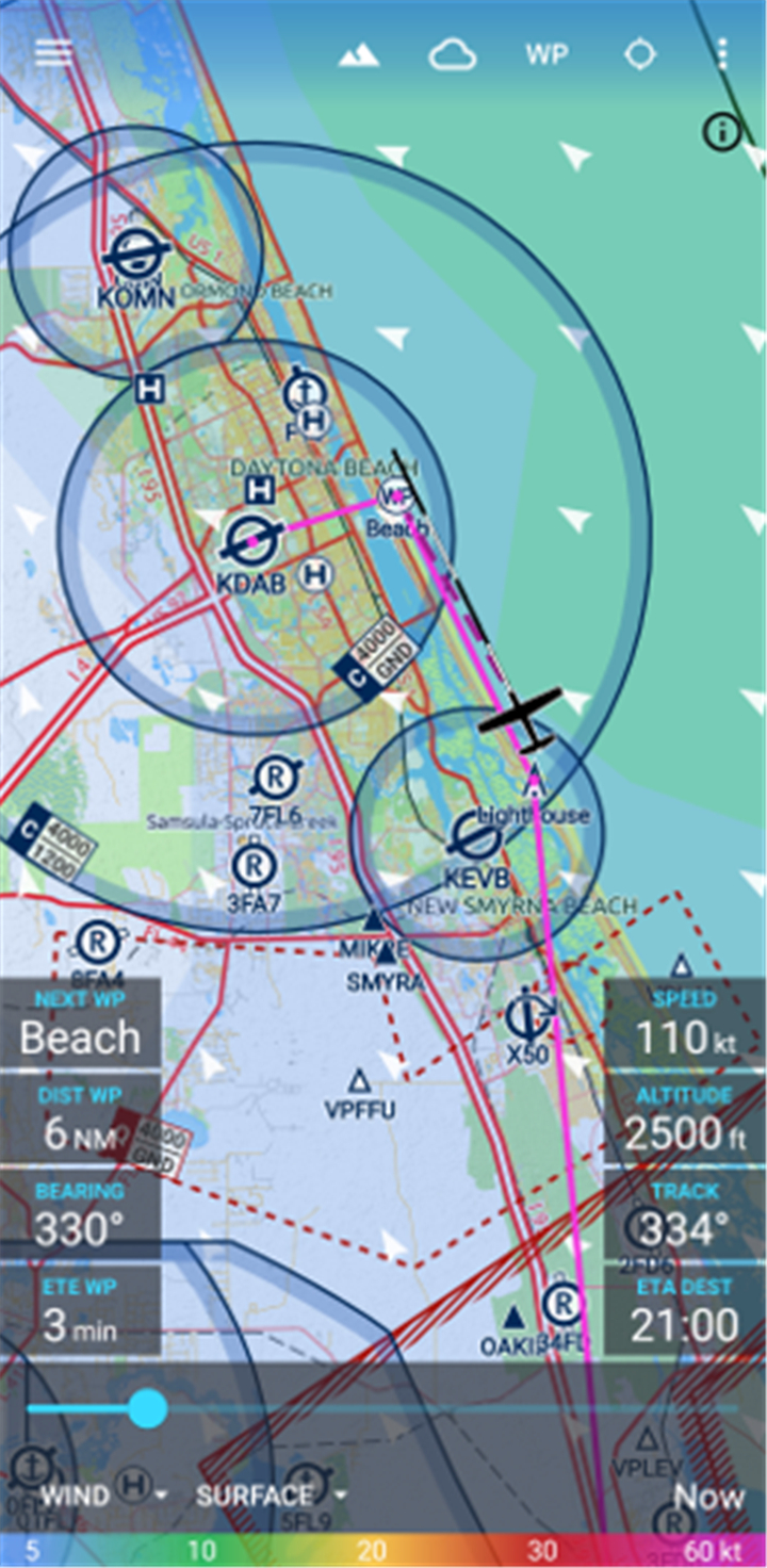
Real-Time and Forecast Weather Layers:
This feature allows overlay of accurate weather data like wind, precipitation, cloud cover, and ceiling from global DWD and NOAA sources, even during flight.
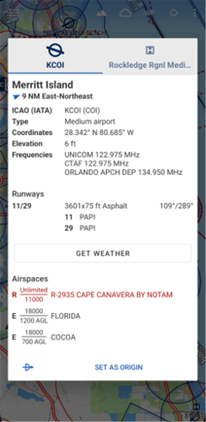
Integrated METAR and TAF Reports:
This feature allows real-time access to airport-specific METAR/TAF reports via integration with Avia Weather, essential for weather-based decision making.
Dynamic Terrain Awareness:
This feature highlights terrain based on your current altitude, enhancing situational awareness especially in mountainous areas.
Traffic Information Display:
This feature allows you to visualize real-time aircraft traffic using your portable ADS-B receiver or the SafeSky app through GDL90 protocol support.
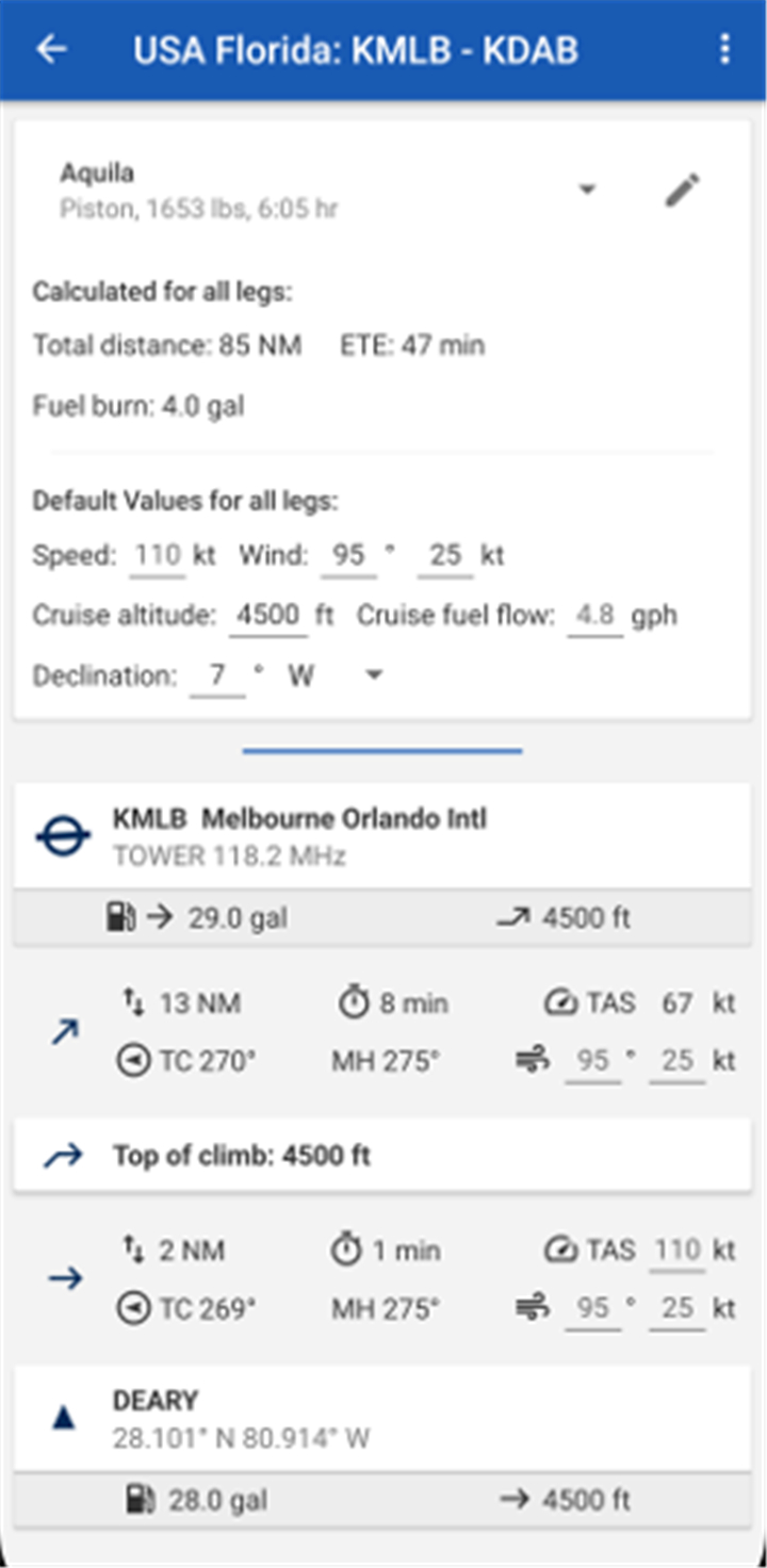
Aircraft Profile-Based Route Calculation:
This feature allows accurate route planning by building aircraft profiles from climb performance and fuel burn values, calculated using aerospace engineering principles.
Multi-Device Synchronization:
This feature allows you to sync routes, user waypoints, and aircraft profiles across all your devices seamlessly.
ICAO-Style Map Interface:
This feature ensures visual consistency and clarity with ICAO Annex 4 styling, familiar to any pilot used to paper-based charts.
--------✦ COUNTRY OF ORIGIN AND LANGUAGE ✦------
Country: Germany
Original Language: English
--------✦ RECOMMENDED AUDIENCES ✦------
Avia Maps is ideal for general aviation pilots, flight instructors, student pilots, and serious aviation hobbyists who require reliable, ICAO-style charts and global airspace data.
It’s especially helpful for those flying VFR and operating in multiple countries with variable terrain or airspace complexity.
Frequently Asked Questions (FAQ) :
Q: Does it include real-time weather data?
A: Yes, the app includes real-time and forecast weather from DWD and NOAA, and supports METAR/TAF integration.
Q: Can I track other aircraft on the map?
A: Yes, with a compatible ADS-B receiver or SafeSky integration, you can view nearby air traffic live.
Q: Is terrain awareness included?
A: Yes, the app features a digital elevation model with dynamic coloring based on your altitude for improved terrain awareness.
------------------------------------------
Contact us at the following sites if you encounter any issues:
Official website: here
Email: support@goremy.co
------------------------------------------
Version History
V3.17.7--------- 10 Jun 2025
Bug fixes and improvements.
- AppSize38.91M
- System Requirements5.0 and up
- Is there a feeFree(In game purchase items)
- AppLanguage English
- Package Namecom.mytowntonight.aviamap
- MD525e8f2d52b7aa46845068f786da7602e
- PublisherRemy Webservices UG
- Content RatingTeenDiverse Content Discretion Advised
- Privilege19
-
Avia Maps Aeronautical Charts 3.12.5bInstall
38.91M2026-03-24Updated


8.6
1335 Human Evaluation
- 5 Star
- 4 Star
- 3 Star
- 2 Star
- 1 Star